| KSi | Knowledge Sciences, Inc. | |
| Terrain Analysis System - Hypertext Output |
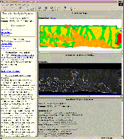
Hypertext OutputKnowledge base execution can produce many intermediate results in the form of delineated landform images and text. These results consume memory and are not retained beyond program termination. An HTML page generation capability can be used to preserve and organize these results. An HTML function library implemented in rule language is used by the KB's in result generation. The imagery and landform characteristics are written to output files along with HTML formatting and hyperlinking commands. The resulting web of hypertext pages, imagery and graphics can then be interactively "browsed" using any commercially available browsing program. Each time the system is executed a subdirectory is generated that automatically documents the system output as a complete, hyperlinked web of HTML pages that can be browsed at any time. All of this is made necessary by the amount and complexity of the output generated by the system. The implementation described below is a sample that we have implemented. The HTML function library used by the KB's are in ASCII and can easily be changed to accommodate any design that the user may require.
|
The following is a working example of the HTML output capability. Click on it to activate it.
|
|||||||
|
Copyright © Knowledge Sciences, Inc. PO Box 3385, Ponte Vedra Beach, FL 32004-3385 904-280-7478 bleighty@knowsci.com
|
||||||||