| KSi | Knowledge Sciences, Inc. | |
| Terrain Analysis System - Graphical User Interface |
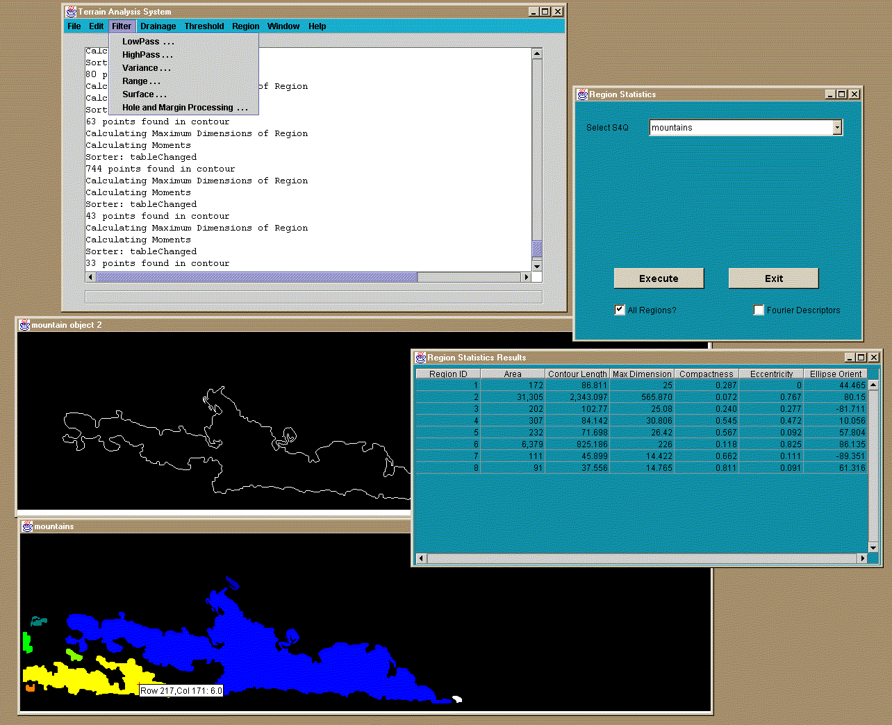
Interactive Graphical User InterfaceA capability for a "Semi-Automated Terrain Analysis Mode", where the user can edit and augment the automated KB generated results, has been developed and can be accessed through a menu on the main control console of the application. This menu interface allows the user to interactively utilize most of the processing functions used by the landform knowledge bases. In addition there are interactive functions available for editing results. As shown, the current main menu functions are File, Edit, Filter, Drainage, Threshold, Region, Window, and Help. The choices for File include the capability for the direct execution of knowledge base rule files. Some of the choices here and in the other main menu functions provide further submenus. For example the Save As choice under File allows for either IfsarDataSet or Windows bmp File, and the Export choice will provide for either ArcView or Surfer output files. The Edit choice provides the capability of cutting/pasting/copying regions from one image window to another. It is also possible to use the Draw/Merge and Erase/Separate functions under Edit to modify the results of segmentation processing or to change general image data itself using a pixel painting approach. The Filter menu is concerned with the surface filtering and morphometric derivatives. As for most of the image processing operations, relevant surface filtering parameters are under user control through the graphical interface. Where useful and if desired, the capability of outputting the results of operations to new windows is provided. |
|
||
|
The Drainage menu provides access to the functions that generate the various types of drainage maps. Interactive capabilities are provided to mask and generate drainage statistics. The Threshold menu provides for thresholding functions that operate either on the display only or on the underlying data itself. The values to be used for thresholding can be entered manually into the text fields of the interface, or the mouse can be used to select values from the image. The Region menu implements segmentation and contour delineation; texture statistics, and shape statistics. This is shown in the graphic above where the region statistics function has been selected. |
The Window menu provides for the creation of new windows or applying different views to a current window (as for example, changing the color map). And finally, the Help menu is used to access System information. For example the user can access JavaDoc-generated documentation on the Java system class hierarchy or the system collection of methods and member variables. During the development phase of this effort, the Semi-Automated Mode has proven to be a powerful tool in the development and exploration of the terrain processing tools provided by the system. During actual use of the system, the tools provided with the Semi-Automated Mode are envisioned to be used to enable human interaction and refinement of the results generated by automated inference engine processing. |
||
|
Copyright © Knowledge Sciences, Inc. PO Box 3385, Ponte Vedra Beach, FL 32004-3385 904-280-7478 bleighty@knowsci.com |
|||